|
<< Click to display Table of content >> Model parameters |
  
|
|
<< Click to display Table of content >> Model parameters |
  
|
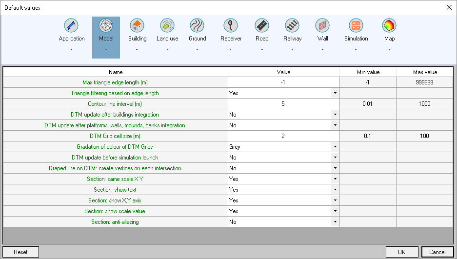
These parameters are used when creating or updating terrain and DTMs (see Terrain creation):

Model settings
•Max. triangle edge length: maximum filtering distance of triangles (see details on overlap distance): 0 for an infinite distance, -1 for a distance automatically calculated by MithraSIG.
•Triangle filtering based on edge length: activates/disables the filtering of very large triangles when simulating the DTM. This parameter is based on the overlap distance.
•Contour line interval (m): default interval used for the interpolation of contour lines in the Create Terrain interface when creating terrain from points.
•DTM update after building integration: function that automatically updates the DTM after building integration.
•DTM update after platforms, walls, mounds, banks integration: function that automatically updates the DTM after integration of these objects.
•DTM Grid cell size (m): Cell size of grids representing terrain in the 'DTM' overlay, generated when the DTM is created or updated.
•Gradation of colour of DTM grids: colour of grids representing the terrain in the 'DTM' overlay. The available values are:

•DTM update before simulation launch: update of DTM (triangulation and DTM grids): compliance with simulation.
•Draped line on DTM: create vertices on each intersection (with DTM triangles) when a line is draped and default option in integrations.
Parameters for the Section interface:
•Section: same scale XY: apply or not the same scale to the X and Y axis.
•Section: show text: show or not the text in the section visualization if there is any.
•Section: show XY axis: show or not the X and Y coordinates axis.
•Section: show scale value: show or not the scale values in XY distance and Z coordinate.
•Section: anti-aliasing: apply or not an anti-aliasing to improve visual rendering.