|
<< Click to display Table of content >> Map parameters |
  
|
|
<< Click to display Table of content >> Map parameters |
  
|
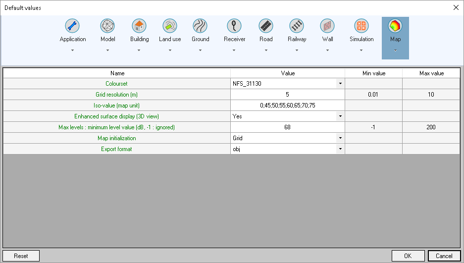
These parameters are used by default when a new map is created.

Maps settings
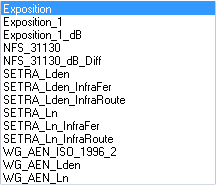
•Colourset: default colourset offered. The application's possible values are (the user can create values via the theme interface):

•Grid resolution: resolution offered when a grid type map is created.
•Isovalues: isovalues offered when an Isovalue or Polygon type map is created. If there are several values they are separated by a ';'.
•Enhanced surface display (3D view): enhancement or non-enhancement in 3D of surfaces (valid for polygon type maps (facade)). Items created are TIN transformed (triangulation). The effect of this is to avoid having objects become invisible for the sake of simplicity in 3D views.
•Max levels: minimum level value: option during simulation and access to the population by interval interface, for adding a line to the table showing the limit value beyond which a combined simulation is carried out (in this case > 68 dB).

•Map initialization: indicate the default type of map. Possible types are:
![]()
•Export format: format of the exported file. Possible formats are (.bds is editable):
![]()