|
<< Click to display Table of content >> Export an overlay |
  
|
|
<< Click to display Table of content >> Export an overlay |
  
|
MithraSIG supports several file formats for export: .shp, .dwg, .asc, .kmz...
Before exporting an overlay, it's necessary to set the table. The attributes exported are those set in the table and not all the attributes of the items. This in order to optimize the export. It also provides a better control over exported data.
Export an overlay
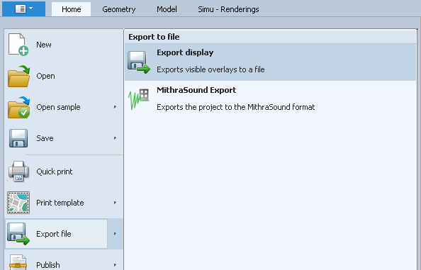
The export of an overlay can be done from the menu File/Export file, or using the right-click on an overlay.
From the menu File, only the visible overlays will be available for export. Moreover, depending of the export format chosen, all the items can be exported in the same file (this is the cas for .dwg for example).
From the right-click on an overlay, only the items contained in the overlay will be exported.

Export from menu File

Export from an overlay
For any export MithraSIG requests to choose the projection. Then, choose the format of the file and set the parameters depending of the format.
Quick export
The quick export is available for any overlay inside the model. The quick export has 3 presets, depending of the overlay selected:
•Kmz (Google Earth): available for any model overlay. Note that you can use the right-click / Kmz / Export... on any items of the project.
•Shp (Shape): available only for the polygon maps.
•Population (CSV): available only for the maps, contains the population statistics.
•Simulation receiver (CSV): allows to export simulation receivers in table format.
Visu Google Earth
If Google Earth desktop is installed on the machine executing MithraSIG, this function allows to see directly in Google Earth without an export.