|
<< Click to display Table of content >> Z Accuracy |
  
|
|
<< Click to display Table of content >> Z Accuracy |
|
The French Geographic Institute (IGN) and more and more data providers are delivering the ground in the form of ASC grids with small pixel size (1 m or even 10 cm).
MithraSIG creates a ground as points and contour lines. The integration function converts grids (“ASC” format for example) into points. The major problem lies in the fact that the number of points produced is huge (several millions) and not very relevant in the zones of almost flat landscape where the ground has no effect on the acoustic propagation (outside the ground effect).

Example: we have four ASC grids of 1000 x 1000 pixels with a pixel size of 1 m, that corresponds to four million points on 4 km².
Operating principle
The Z accuracy function reduces the number of points from these grids by considering a maximum tolerated difference chosen by the user between the initial and produced data.
An altitude comparison is done for each point between a complete data triangulation and an approximate triangulation while remaining within the tolerance. The result thus obtained represents the feature points of the ground: ridges, peaks, valleys, slope breaks, and mounds. These are the points that we seek to identify and to model in acoustics.
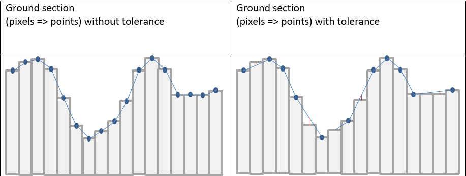
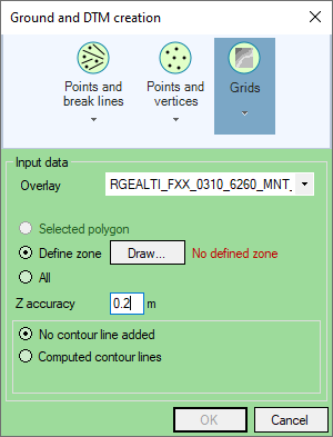
Ground creation with a tolerance of 20 cm
Consequence on the ground
Tolerance |
None |
20cm |
1m |
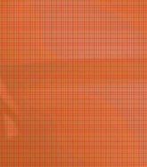
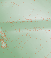
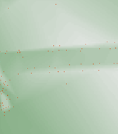
Number of Ground points |
4.000.000 |
14.881 |
1.495 |
Visualization of Ground points |
|
|
|
A tolerance of 20 cm divide the number of points by 250. The average deviation (with the original data) is 10 cm.
With a tolerance of 1 m, there is an average loss of precision of 50 cm and a theoretical maximum loss of 1 m. We reduce the number of points by more than 2600.
Consequence on simulation
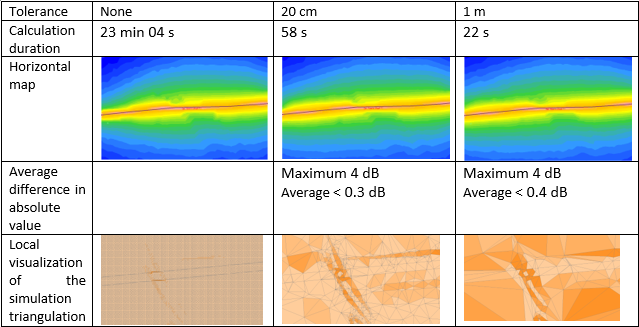
Comparisons are made with all the same calculation parameters. The average difference is made in absolute value in order to avoid that errors compensate each other.
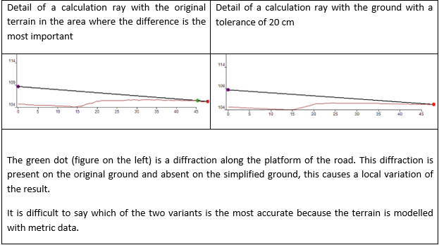
The differences of calculation with and without simplification of the ground are weak. However, locally, one can find important differences: some rays appear as diffracted in one case and not on the other. This is especially true in the NMPB08 method where the height of the source is low (5 cm).
Conclusion
Simplification of the terrain depends on the wanted precision of the simulations: this precision varies between a city cartography and an environmental impact study.
We calculate from ray tracing: details below the wavelength (less than 10 cm) do not improve the precision of the simulations. We advise to always simplify the data (with a tolerance of 10 or 20 cm) which significantly reduces the number of points and computation time without altering the results.