|
<< Click to display Table of content >> Z Accuracy |
  
|
|
<< Click to display Table of content >> Z Accuracy |
|
More and more ground are grids (ASC Format) with millions of points. A new parameter was added to optimize MithraREM ground creation. This new Z accuracy parameter reduces the number of ground points with a very limited lack of precision.
It reduces points considering a maximum tolerated gap between the initial data and MithraREM ground. An altitude comparison is done for each point between a complete data triangulation and an approximate triangulation while remaining inside the tolerance.
The result thus obtained represents the ground feature points: thalwegs, crests (mounds), summits, hollows, break points (banks).
Tolerance |
None |
20cm |
1m |
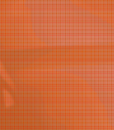
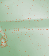
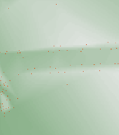
Number of Ground points |
4.000.000 |
14.881 |
1.495 |
Visualization of Ground points |
|
|
|
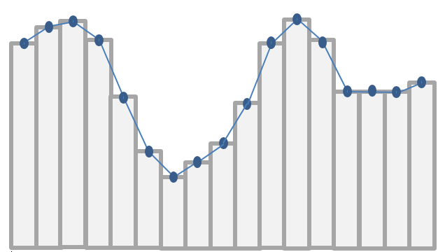
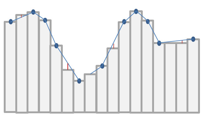
Operating principle
Ground section (pixels => points) without tolerance |
Ground section (pixels => points) with tolerance |
|
|