|
<< Click to display Table of content >> New features of the version 2.0 |
  
|
|
<< Click to display Table of content >> New features of the version 2.0 |
|
This is an overview of the main new features in MithraREM 2.0. For more details, please refer to the release notes.
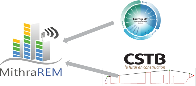
Coupling the Mithra engine to a GIS
•Integration of the Mithra simulation engine (CSTB) in a GIS platform (SIS/Geomod)
•Take benefits of all the functionnalities of the GIS.
Before, in MithraREM 1, the Mithra engine was added in a GIS platform, like adding new features to a GIS.
Now, in MithraREM 2, the GIS graphic engine and the Mithra engine are integrated into one dedicated software.
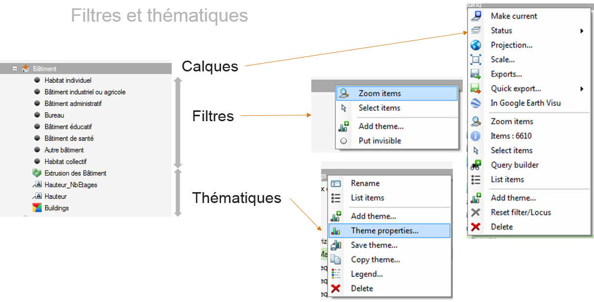
Benefits
>before: generic interface of the GIS
>now: specific mapping interface
oEasier to use
oMore intuitive
Development concept
|
•Full integration •A new interface •Full 64bits •More intuitive •Easy of use |
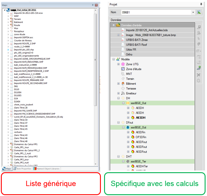
The project panel
The layer window has been redesigned. In version 1, there was a list of overlays where the position in the list was the display order in the graphic view. In version 2, the overlays have a type. The data is stored with the entry data, the data of the model and the simulations.
The simulations
The simulation/domain logic has been inverted. A simulation are (= domain) has to be created first, then the associated simulation.
In version 1, a simulation had one or several domains, each simulation had its maps.
In version 2, the domain has one or several simulation, each simulation has its maps. The domain only corresponds to a geographical area. The type of simulation (facade, horizontal, ...) is now stored in the simulation.
Benefits: this facilitates the engineering work, several simulations can be created with different parameters in order to compare them.
Objects properties
All the properties of the objects are visible from the graphic window when clicking on an object.
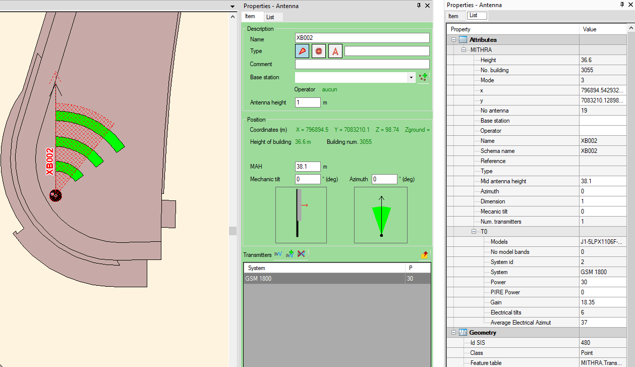
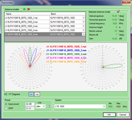
Antenna variants
Adding the possibility to simulate antennas variants with the maximum level by antennas.
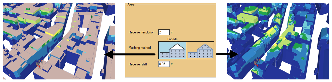
Map in facade with roofs
Now, if the model has roofs, 2 meshing methods are available:
•Model with the roofs
•Extension of the facades until the bottom of the roofs.
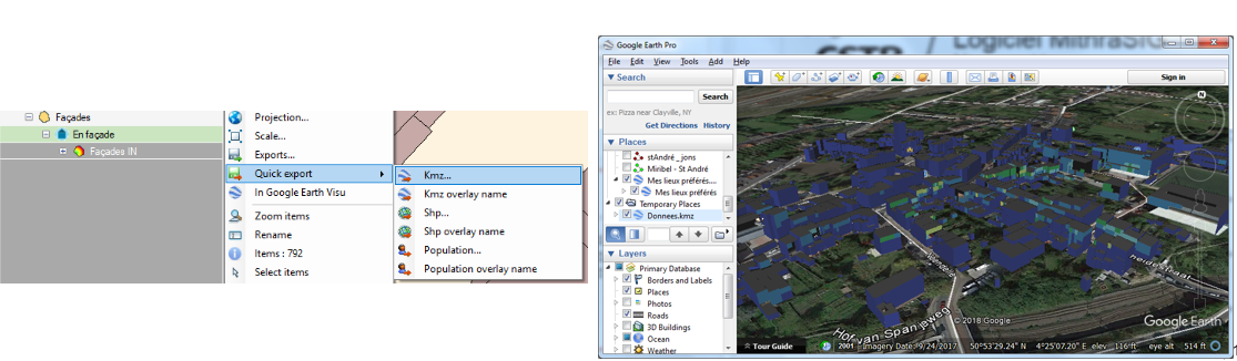
Export KMZ
In version 2, the exports to KMZ and SHP are pre-formatted and optimized for the different types of objects. You can easily visualize those objects in all software that can read KMZ file like Google Earth.
Several overlays can be exported in same time (SHP or KMZ formats).
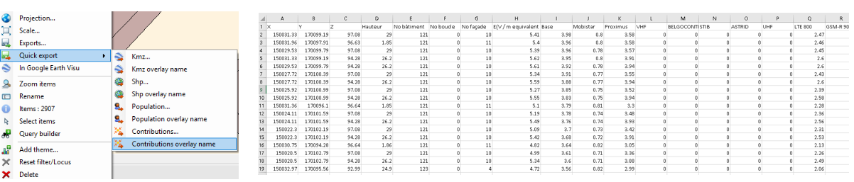
Contribution analysis
The version 2 makes easier the analysis of simulation results.
For all points renderings (simulation receviers, maximum levels, ...), specific attributes are created corresponding to:
•The cumulative level by antennas
•The cumulative level by frequency bands
•The cumulative level by operators
Theses analysis are available for all types of simulations (horizontal, vertical, facade, terrace, indoor) and for all simulation methods.
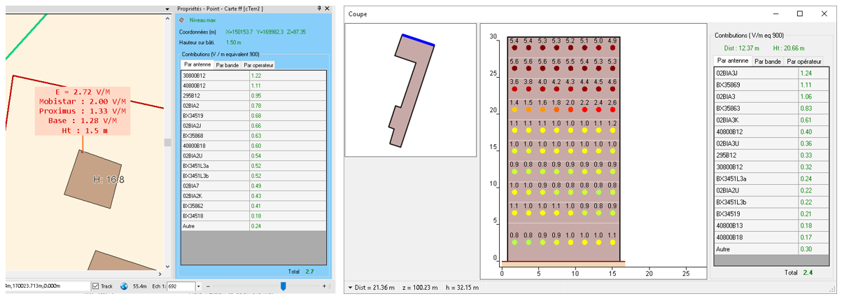
The contributions can be easily exported for Excel in a table.