|
<< Click to display Table of content >> Integration of land use |
  
|
|
<< Click to display Table of content >> Integration of land use |
  
|
The land uses to integrate must correspond to objects of type polygons.
Depending on the type of area selected (water, vegetation or urban), a material is associated with the area created. This material is defined in the default parameters.
To integrate land uses, from the ribbon Model, click on the button ![]() in the group Integration.
in the group Integration.
The Integration window is displayed.
•Click the Land Use button.

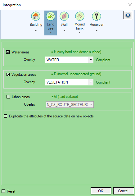
Land use integration
•Check Water areas, Vegetation areas and/or Urban areas.
•Enter for each type of surface checked the Overlay containing the data to be integrated.
The option Duplicate the attributes of the source data on the new objects is used to copy onto the new objects the attributes present on the original objects which served as the basis for their creation.
The Reset option deletes all old land use area polygons already present. By leaving this option unchecked, you can then add the polygons to the existing 'Land Use' overlay. It is then possible to make several successive integrations in different geographical areas and for different polygons.
•Click OK to confirm.
MithraSIG has many helpful features to simplify integration of data and providing information on errors made by the user. With land use, a test checks whether the data is areas and the result is: 'Compliant' or 'Not compliant'.

Geometry test of selected data
The land use is added to the project and a 'Land Use' overlay is added to the composition. It corresponds to the 'Var_X_LandUse.bds' file created and saved in the project directory. It contains the water, vegetation and urban areas.