|
<< Click to display Table of content >> Simulation parameters |
  
|
|
<< Click to display Table of content >> Simulation parameters |
|
The simulation parameters can be found on the Parameters tab in the Simulation window.

Simulation: settings
Parameters
•Cutting period: reminder of the cutting period used in the project.
•Default material of simulations for 'blank space' in the model i.e. the simulation tracer is not on any object (a white zone in the Graphic window).
•Geometric tracers: ray propagation methods (from the receiver).
oFast ray method: can be used for strategic maps with, for example, an angle of 3 to 10°. The method used by MITHRA V2 allows extremely rapid searching of the most relevant paths with early elimination of low level paths.
|
Fast ray method is particularly adapted to dense urban areas. In this method the effect of reflections have more importance than diffraction over obstacles. It is advisable to use the fast ray mode with at least two reflections. |
|---|
oRay method: can be used for strategic maps and impact studies with, for example, an angle of 3° to 10°. It makes it possible to search paths rapidly without eliminating low level paths. All paths may not necessarily be shown.
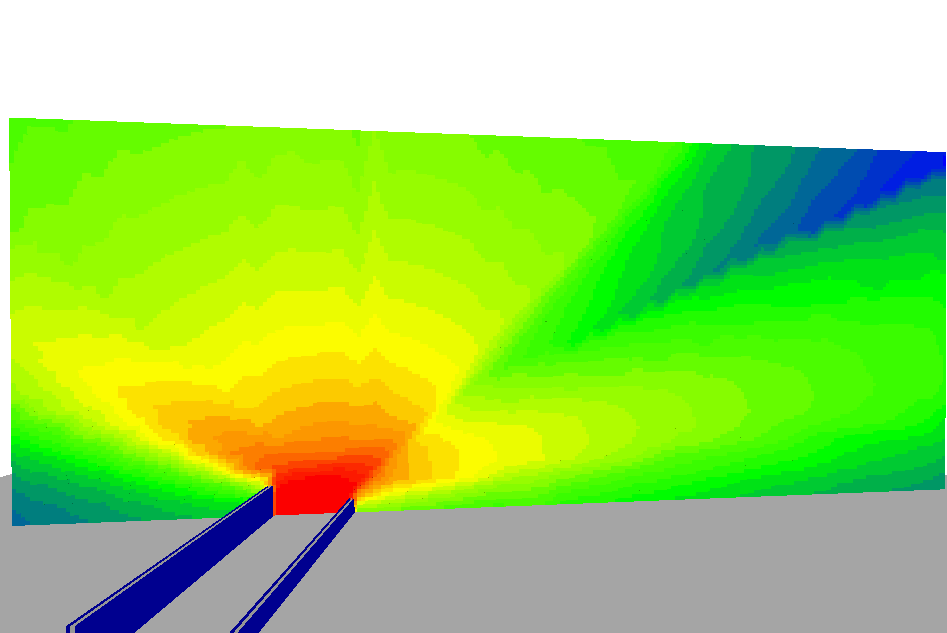
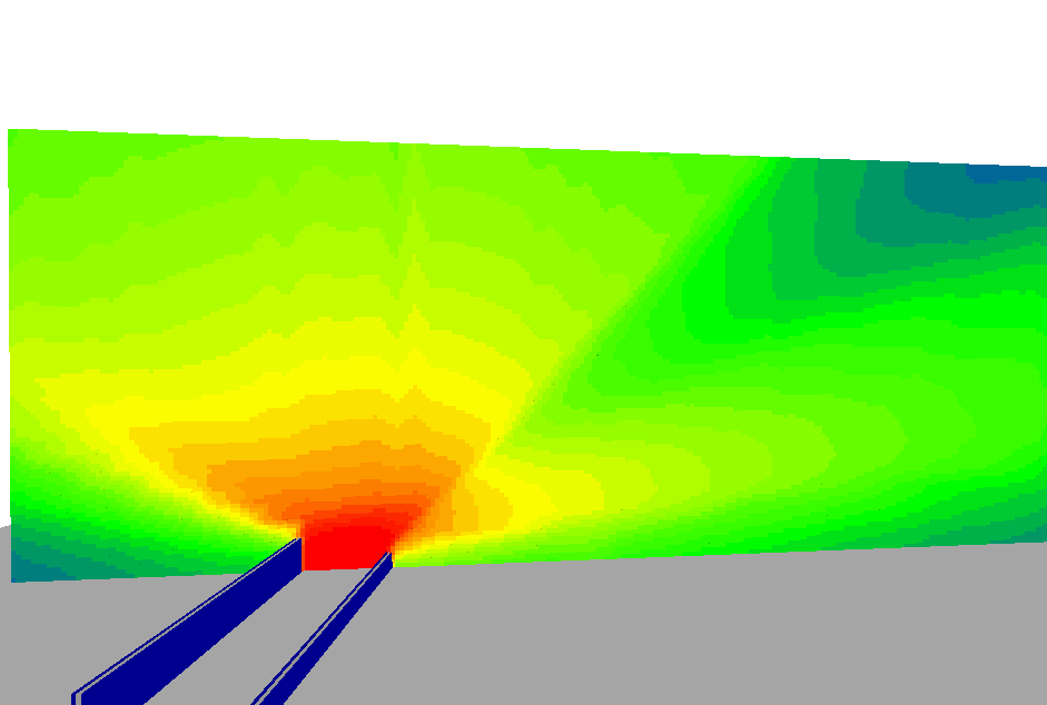
oBeam method: can be used for impact studies. All paths between the sources and the receiver are shown. It also allows vertical diffractions on the edges of the screens. The angle corresponds to the source sampling method. The number of paths found (and therefore the simulation time) is much greater in beam mode.
•Maximum propagation distance: the maximum distance that a ray can travel from a source. It must be adapted to the scale and complexity of the site being studied. The simulation time is in proportion to the Maximum distance selected. You can allow a distance of 500 m. in urban areas and 1,000 m. in rural areas.
•Angle or Angular step: the angle between two propagated rays. The smaller it is, the greater the precision of the simulation (but it will take longer). The angle is between 1° and 30°.

Sampling angle in beam mode
•Number of reflections or Maximum number of reflections (on buildings) included during propagation:
oThe simulation time is exponential with this parameter.
oIt can be limited to 2/3 for cartography.
•Fresnel reflection: taking into account the reflection extended to the Fresnel zone (as opposed to a specular reflection). Simulation with Fresnel reflection are more precise. We recommend this setting.
Fresnel reflection off (i.e. specular reflection) |
Reflection extended to the Fresnel zone |
|
|
•Lateral diffraction on screens: taking into account diffraction on the lateral angles of the screens. Only valid in beam mode. The simulation time is increased with this parameter.
Method
•Road sources emissions method: NMPB 08, Mithra-CSTB (NMPB 96 eq PL), AR-INTERIM (Guide du Bruit (noise guide)), Harmonoise, CNOSSOS-EU.
•Propagation method: Harmonoise (1/3 oct), Harmonoise (oct), ISO 9613-2, NMPB08 (1/3 oct), NMPB08 (oct), NMPB96, CNOSSOS-2012, CNOSSOS-ISO 9613, CNOSSOS Harmonoise.
The method CNOSSOS-2012 is the one used for the European Standard. The simulation library used is the one developed for CNOSSOS project.
CNOSSOS-ISO 9613 is an interpretation of the method ISO 9613 realized by the CNOSSOS expert group. It should be noted that the ISO method has several grey areas (not defined by the expert group) and each software can interpret the standard differently. This can lead to high local variations between software results.
CNOSSOS-Harmonoise is an adaptation of the Harmonoise method taking into account the progress of the CNOSSOS project.
|
The NMPB08 and Harmonoise simulation methods are shown in 1/3 octave and octave. Carrying out simulations in octave reduces simulation time. |
|---|
Meteorology
•Selection of city for meteorology.
•The choice of meteorology for each period with temperature (°) and humidity (%). A specific meteorology can be chosen for each period so that the meteorological conditions can be varied during the course of a simulation. If the meteorological periods chosen do not match the simulation periods, the user must enter these periods (the drop down menu is initialized as empty).