|
<< Click to display Table of content >> Simulation Triangulation |
  
|
|
<< Click to display Table of content >> Simulation Triangulation |
|
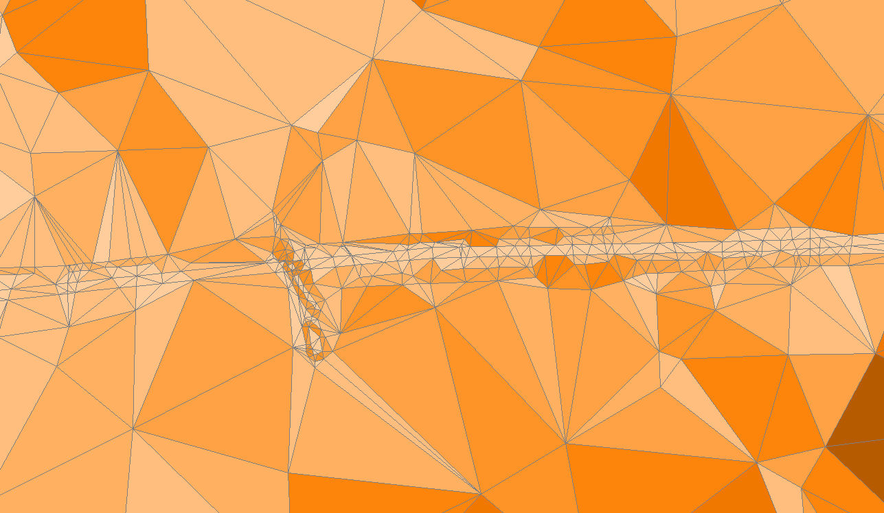
Simulation Triangulation
This version enables to visualize the triangulation associated with any completed simulation in the form of polygons from a specific overlay. This triangulation is the internal model used to calculate the 3D sections of the calculation paths. Each triangle edge intersected by a calculation path adds a point representing the terrain to that section.
A gradient of color is displayed according to the slope of the triangles ; flat triangles appear in white and triangles with a slope greater than 10% appear in dark brown. This allows a better analysis of the calculation ground effects.